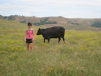
The terrain was a combination of everything we've seen so far. We were supposed to do 12 miles today; we did 14.7. Go figure. Mapping isn't a perfect science as I've mentioned before :>). Once again, Mark waited until we were done to tell me this. I was grateful for this.
Before I get to pictures and comments about the day, I thought I'd give some statistics that Map Guy gave me regarding our trip. You data heads will love this; I did:
Day 1 - 12.2 miles, 2:24 moving time, 3084' total elevation gain.
Day 2 - 14.0 miles, 2:41 moving time, 2750' total elevation gain, max elevation of 2557'.
Day 3 - 16.2 miles, 2:46 moving time, 1354' total eleveation gain, 3163' total descent.
Day 4 - 14.7 miles, 2:46 moving time, 2647' gain, 2750' total descent.
Day 1 -4 . . . 57.1 miles, 9835' total elevation gain, 2 sore knees (not Erin's), and 3 blisters (2 Erin's).
 We started today in Olema. Our first milestone would be Mt. Whittenberg, then Reyes Hill, and then would be mostly downhill to Inverness.
This is just outside Olema at the Visitor's Center. Off we go.
 From left to right:
We can see "it" (the climb) coming toward us.
Two shots of me suffering up the climb. The scenary is nice though, right?
The final push.
Here we are after the climb. He snapped my picture before I got to compose myself. I look as bad as my legs feel, whereas he looks like he's fresh as a daisy.
At this point, Map Guy says, "I'm going the additional .2 miles to the top of Mt. Whittenberg because I want to summit. You can hang here if you want." I'm thinking "Of course you do and no I'm not hanging". I say, "Sure, I'll go with you". We agree to walk it.
 This was a cool shot on our way up the summit.
And then, this is the Summit. I think a little chuckle might have escaped my lips at this point. We both agreed it might not have been worth the extra effort (It wasn't, but we had to go . . . mk).
After our anti-climactic summit, we head downwards and then up some again toward Reyes Hill. Best we can figure, this meant going up again and in this case, into the fog.
 The larger pic is on our way up.
The two side shots were part of some government station of sorts. We couldn't figure out what these were. It felt very "other planet like" though.
 Mark on the final descent.
Us very glad about this fact (and we finally came across someone who could take a picture of both of us).
Map Guy doing his best work.
Our trip down would lead us to the town of Inverness. It is a one horse town with very friendly folks.
 A picture of Inverness (I wasn't kidding).
Mark and I posing at the official sign which marks our "doneness". Of course I have to "stick the landing".
And our very favorite person of the day; Elizabeth who as a fellow hiker and runner was more than willing to give us a lift back to Olema.
What a great trip. Somehow we got it all done injury-free for which we are extremely grateful. We're glad to be done running, but we feel like super heros and are more than slightly refreshed and ready to head home and conquer the world. We are grateful to our friends and family for caring for our little people in our absense. Early reports sound like they've had a great time.


